|

- Home
- Trails
- Year of the Bridges
- Tributary C Bridge and Boardwalk
Tributary C Bridge and Boardwalk
By Liam Waterman, GHTC Volunteer
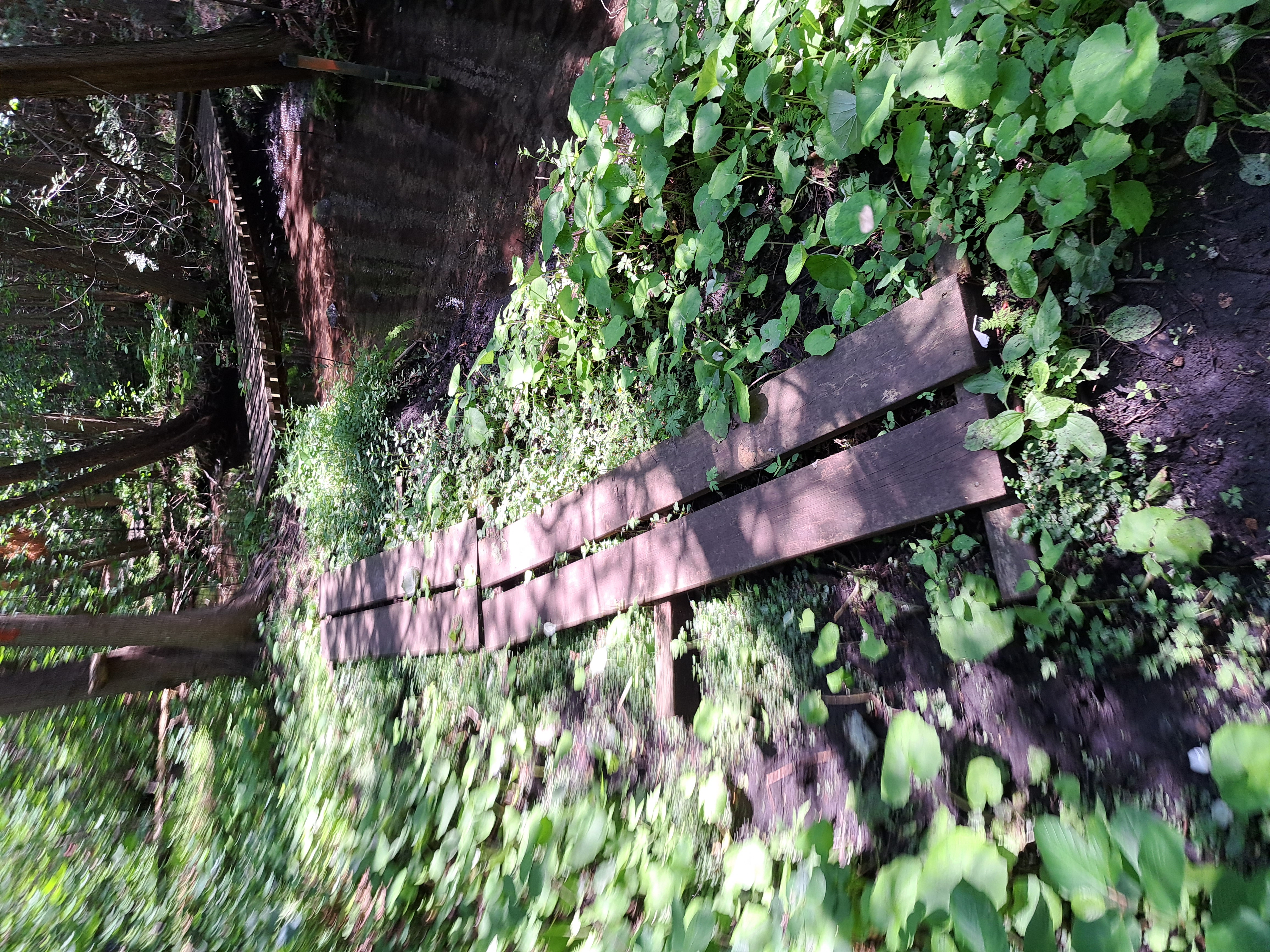
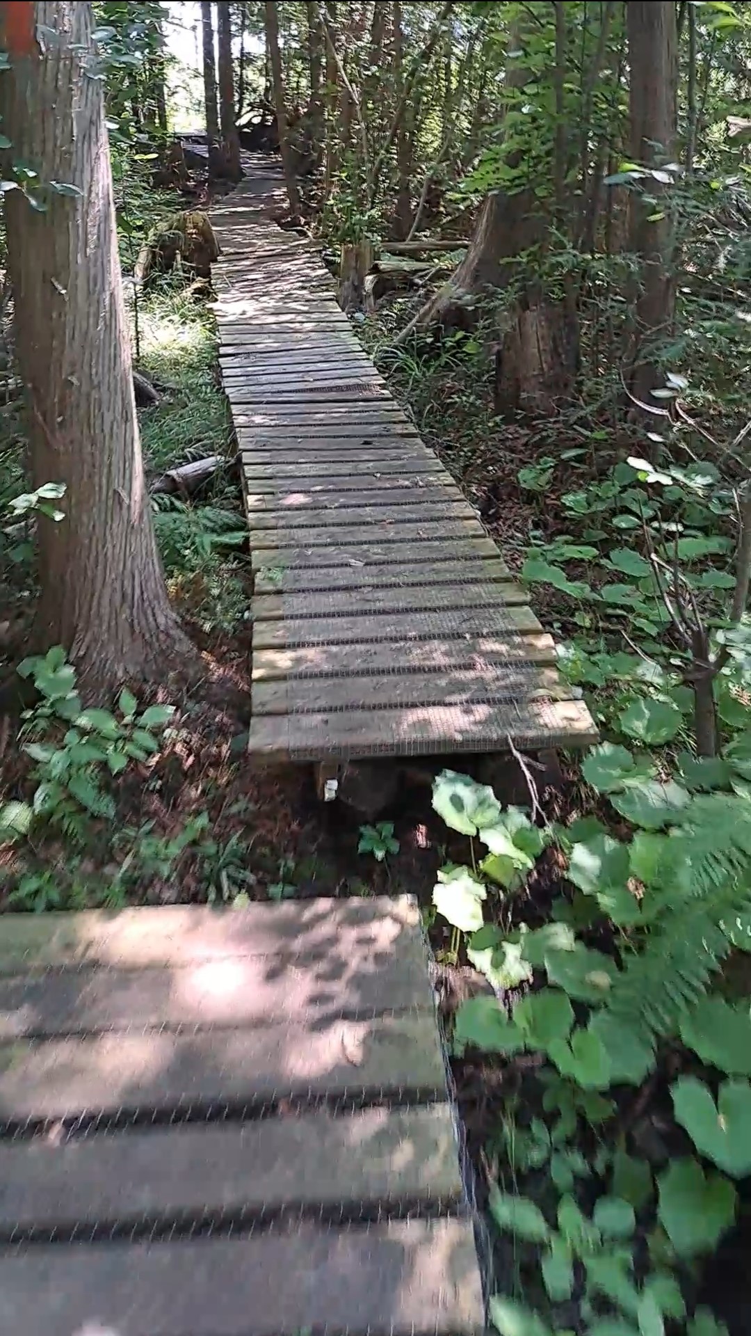
The third section of the Guelph Hiking Trail Club (GHTC)’s Speed River Trail (SRT) is home to a single fifteen-foot wooden bridge spanning a tributary of the Speed River, dubbed “Tributary C”. Surrounding the bridge itself is a much larger system of planks and boardwalk constructed over the course of many years to deal with what GHTC members referred to as “The Big Wet Spot,” a section of the trail that frequently becomes wet and muddy due to saturation of groundwater. The presence of these structures is owed to the longstanding efforts of trail coordinator Bill Mungall, along with a number of other GHTC volunteers including former section leader Andy Cann, who have worked to make this trail more accessible and enjoyable for recreational users.1
The particular geography of this section of the SRT has necessitated the installation of a number of connective structures since its creation in 1973. The section sits on an outwash plain, a large deposit of mixed debris including sand, silt, and gravel formed by the movement of glaciers.2 This porous mix of soil allows water to easily absorb into the ground; this tends to prevent the formation of large streams, but can allow for muddy conditions in low lying areas. “The Big Wet Spot” in particular is located at the bottom of a gradually steepening slope leading up to a cleared area of farmland. Water absorbed into the ground at this area of higher elevation tends to outlet partway down the slope, leading to wet and swampy conditions around the current location of the boardwalk. Due to its proximity to the Speed River this trail also regularly experiences flooding when water levels are high. This can not only make the trail difficult to traverse, but can also lead to bridges being periodically displaced or washed away. The metal bridge on the trail further ahead from the Tributary C bridge for instance, which spans a backwater of the Speed River, was installed to replace a previous tethered log bridge which had washed away due to spring flooding. The current bridge is actually a reutilized aluminum truck loading ramp bought at a scrap yard in Cambridge, which was brought in by Bill Mungall on the back of his canoe. This was the only affordable structure capable of enduring in this location.
Surprisingly, given this context, the Tributary C bridge has a relatively straightforward history. A bridge over this channel was initially installed in 1973 to support GHTC foot traffic. This bridge was simple in design, composed of a number of cedar logs laid from either end of the stream. Since the tributary is much calmer than the river itself, and since cedar logs are particularly resistant to rotting, this bridge managed to last up until 2018 before beginning to show any significant signs of decay. By this time Bill Mungall had already organized a number of work parties over the course of several years to improve and expand the surrounding boardwalk; as one of the last work parties undertaken for the boardwalk, Bill Mungall decided to replace this original bridge. The new bridge once again utilized two cedar logs, over which were laid a number of pressurized decking boards. Materials were brought to location through a farm located at the top of the hill above The Big Wet Spot, owned by the McKittrick family. This saved the GHTC volunteers involved from having to cart materials from the nearest trailhead or take them in by canoe. This new bridge has lasted up to the present day with no significant issues.
Work on the surrounding boardwalk began long before the construction of the current bridge, around 2005.3 This came during a period of change for this section, as Bill Mungall took over as trail coordinator for the SRT this year, while Andy Cann had taken over as section leader the year prior.4 At the beginning of his tenure Andy quickly noticed several wet spots on the trail, and so put together a proposal in 2005 for around 600 meters of new boardwalk.5 Bill Mungall was similarly spurred to action by a chance encounter with several members of the Toronto Bruce Trail Club, who happened to encounter him while undertaking a hike through section 3 of the SRT. One member, Bill Mungall recalls, expressed her surprise at the ill-kept nature of the trail. “Not that I needed to be provoked, but that did get us going on a whole series of work parties to get the boardwalks in place there,” he comments.6 In order to bring materials to “The Big Wet Spot,” which was located relatively far from the nearest trailhead, Andy Cann arranged the aforementioned deal with the McKittrick family (who also owned the land underneath this area of trail at the time) to allow volunteers to access the work location via their farm. This initial boardwalk, which would have been smaller than that present on the trail today, was completed through a series of work parties organized that year.
The following years saw continual additions and repairs undertaken on the boardwalk. Most notably, in 2009 the trail was slightly rerouted to take a shorter path over the wet area, necessitating the construction of 175 meters of new boardwalk.7 By this time ownership of the land had switched to the company Preston Sand and Gravel, who were fortunately supportive of the GHTC’s efforts. During a routine contact with Preston Sand and Gravel in 2010, undertaken by Bill Mungall, their owner decided to give the GHTC an impromptu donation of $600. This money was promptly put towards boardwalk construction.8 Work continued on gradually expanding and improving the boardwalk over several years up until relatively recently, in 2018, when the Tributary C bridge was installed.
While no precise measurement of the boardwalk’s current total length exists, it can take a hiker moving at a reasonable speed several minutes to get from one end to the other. The boardwalk’s individual sections contain a varied mix of designs, reflecting the structure’s gradual construction. Some sections of the boardwalk consist of a number of decking boards laid across stringers, composed of either cedar logs or 6 x 6 inch planks; other sections instead consist of two parallel planks supported by 6 x 6 inch sleepers. A large number of individual planks have also been laid down at various wet areas on the trail nearby to the boardwalk, working to combat the muddy and sometimes treacherous conditions. Despite its relatively low profile, this boardwalk is certainly one of the largest connective structures present on the GHTC’s trails. The presence of this structure, along with the bridge over Tributary C contained within it, makes what would otherwise be a particularly precarious section of trail safe and easy to traverse.
Notes
1. Much of the information in this article was procured through an in person interview with Bill Mungall, August 2023. Many thanks to him for his help in this project.
2. Theel, Markus, et. al. “Assessment of the Heterogeneity of Hydraulic Properties in Gravelly Outwash Plains: a Regionally Scaled Sedimentological Analysis in the Munich Gravel Plain, Germany”, Hydrogeology Journal 28, no. 8 (2020): 2658, https://doi.org/10.1007/s10040-020-02205-y.
3. “Executive Meeting: Minutes of March 15, 2005”, Minutes, Newsletters, Handbooks, Posters, Scrapbooks, Correspondence and Other Items Relating to the Guelph Hiking Trail Club, 1970-, McLaughlin Library, University of Guelph.
4. “Executive Meeting: Minutes of September 21st, 2004”, Minutes, Newsletters, Handbooks, Posters, Scrapbooks, Correspondence and Other Items Relating to the Guelph Hiking Trail Club, 1970-, McLaughlin Library, University of Guelph.
5. “Executive Meeting: Minutes of March 15, 2005”, Minutes, Newsletters, Handbooks, Posters, Scrapbooks, Correspondence and Other Items Relating to the Guelph Hiking Trail Club, 1970-, McLaughlin Library, University of Guelph.
6. In discussion with the author, August 2023.
7. “Minutes of the Annual General Meeting: November 18, 2010”, Minutes, Newsletters, Handbooks, Posters, Scrapbooks, Correspondence and Other Items Relating to the Guelph Hiking Trail Club, 1970-, McLaughlin Library, University of Guelph.
8. Ibid.
Guelph Hiking Trail Club is a charitable organization Registration#11894 9395 PO Box 1, Guelph, ON, N1H 6J6 |